The Phrygian Way Hiking Trail
Frig Yolu
/ By Josh
Cost: Free
Great for: Phrygian History, Cave Cities, Cave Churches,
This article is specifically about the trail, for more about the region, see the Phrygian Valley
Since Turkey’s first major hiking trail, the Lycian Way, opened in 1999, the Turkish hiking scene has been expanding steadily, taking advantage of Turkey’s magnificent coastline, mountains, and inviting climate. While the most popular trails stick closer to coastal mountains, the Phrygian Way offers trekkers a truly unique experience.
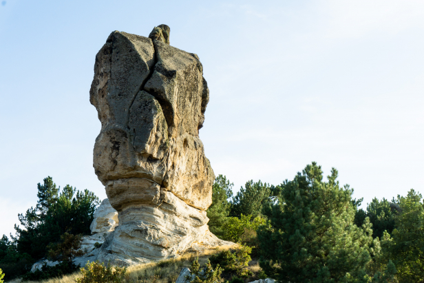
The Phrygian Way (Frig Yolu in Turkish) is a trail network that winds its way through the Phrygian Highlands of Western Turkey for a total of 506 kilometers. What makes Phrygia so unique is the magnificent landscapes formed by ancient lava fields, and carved by wind and water to form strange spires of rock, countless caves, and strange castle-like towers.
The region takes its name from the Phrygian people who, over 3000 years ago, began to carve the soft volcanic stone into temples and monuments. From their capital city of Gordium, where Alexander the Great cut the legendary Gordian Knot, Phrygian culture and art spread through what is now western Turkey. Surprisingly little is known about the Phrygian people apart from their place in legends such as King Midas with his golden touch, or the wars of the Phrygians with the Amazonians.
Between the mystical geography and the history carved into the landscape, the Phrygian Way offers an amazing and unique hiking experience.
Subscribe to the Art of Wayfaring
Apart from the stunning landscapes, here are some of the highlights and sights that you’ll come across on the Phrygian Way.
Yazılıkaya
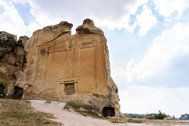
At the heart of The Phrygian Way, where its three branches meet, is the village of Yazılıkaya. Yazılıkaya, meaning inscribed rock, takes its name from the spectacular monuments in the ancient settlement known as Midas City, named after King Midas of the Golden Touch. With massive monuments, cisterns, altars, and tombs Yazılıkaya really captures the spirit of what makes the ruins of ancient Phrygia so special. Check out our full Yazılıkaya guide!
Seydiler Village and Kırkinler
While not right on the trail itself, the village of Seydiler sits just a kilometer away from the trail head itself (south-eastern route). The village is dominated by a tall bank of chalky white dust with spires of rock and fairy chimneys rising dramatically from the bank. Further up the hill behind the village there are numerous fairy chimneys and cones of pale volcanic stone.
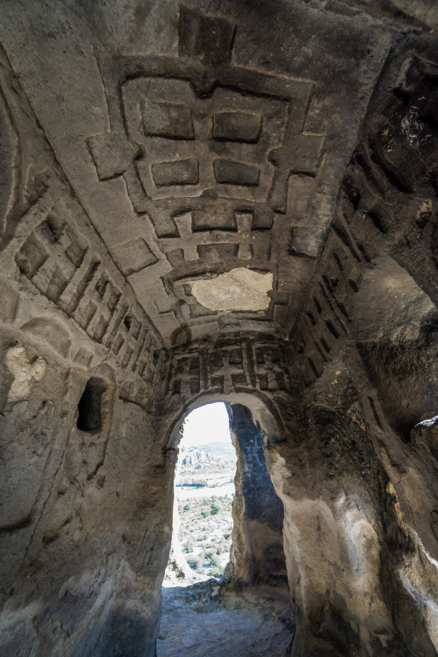
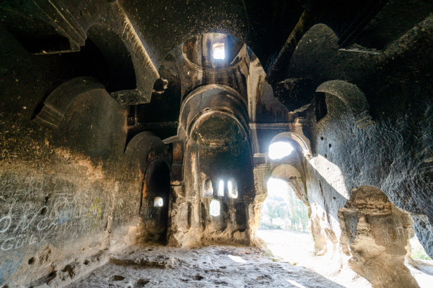
Just outside of the village of Seydiler is a cave filled rock formation called Kırkinler, meaning ‘Forty Dens’. Carved into the tower of stone is a stunning monastic complex consisting of sprawling vaulted chambers decorated with numerous crosses carved in different styles and sizes on walls and ceilings.
Ancient Roadways
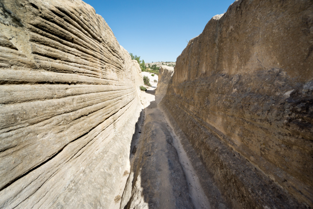
Throughout the lands of the Phrygians you can find cart tracks that have worn deep ruts into the soft volcanic stone. In some places these ruts were carved out into narrow canyon-like roadways.
Gordion Ruins
Also known as Gordium, this site having been inhabited for 4,500 years, reached a zenith around 600 BC as the capital of the Phrygian civilization. The site consists of the ancient city mound and numerous tumuli (burial mounds); the best known of which being the tomb of the Phrygian’s most legendary ruler: King Midas.
This site marks the far North-Eastern start of the trail, cutting through terrain that is mostly flat and tilled compared to the forested hills of the southern and western portions of the trail.
Ayazini Rock Church
The Ayazini rock church is the main highlight of the ruins of ancient Ayazini, a settlment dating as far back as the Phrygian period. The area around the village of Ayazini is home to a Byzantine era rock cut church, rock spires, and numerous tombs. Today’s village only occupies a small portion of the ancient city. The fairy chimneys and rock cut tombs blend with the modern homes making for an absolutely fascinating atmosphere. Just outside of the village is the cave-filled rock formation known as Avdalaz Castle.
Aslantaş and Yılantaş
The Göynüş Valley (sometimes written Köhnüş) is thought to have been a sacred place to the Phrygians and is home to the largest Phrygian Necropolis found to date. The Aslantaş tomb is impressive and the nearby Yılantaş, though heavily damaged, is worth seeing. Aslantaş meaning ‘lion rock’ is a monument with a pair of rearing lions carved over a small opening in the rock. Confusingly, Yılantaş, meaning ‘Snake rock’ is also a rock monument of a lion. The Yılantaş monument is said to have once had a great snake carved into it though today all that’s left is the head of a lion.
Across from them is the Göynüş Castle, a great block of stone resembling swiss cheese with all its hollows that have been carved into it. This particular valley is full of interesting rock formations and picturesque green meadows.
Arslankaya
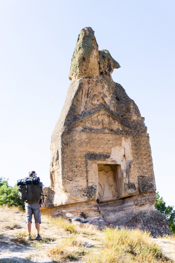
Meaning Lion Rock, this is a monument cut from a single block of stone with a niche at the bottom likely for the idol of the goddess Cybele, chief god of the Phrygians. A pair of rearing lions carved into the rock spire, above the niche give the place its name.
About the Trail
-The trail does not run in a single line. Rather it’s made up of three spokes running out from a centre point at the Yazılıkaya rock-cut monument, one of ancient Phrygia’s most impressive sights.
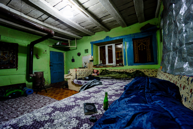
-While the region is sparsely populated, the trail frequently passes through villages, some of which will have rooms for hikers to stay in and, in some cases, have shops selling food.
-Weather here is warm to hot from spring into the early fall, though temperatures drop considerably after sunset. While August can be quite hot, the weather is good for hiking from April to November. As the route covers a wide area with varied climates we’d recommend you check weather report of the nearest cities for more specific information.
-The trail itself is marked with the same system of markings as the rest of Turkey’s long-distance trails: white and red stripes. Various types of markings are used to indicate turns, junctions etc. There are sections of the trail lacking in rocks and trees where flagging tape has been used.
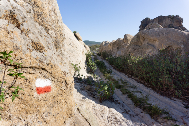
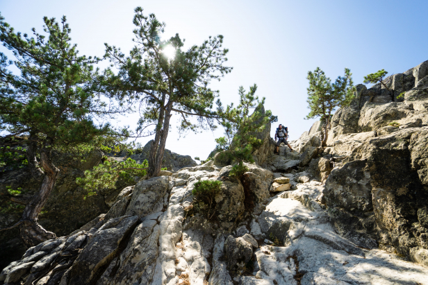
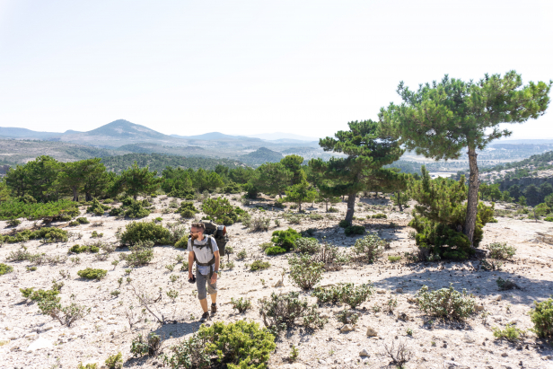
– The Phrygian Highland is predominantly hilly with a few flat plain type regions thrown in. While you will hike up the occasional steep hillside, it’s by no means mountaineering and the slope is generally easy to moderate.
-While the trail is predominantly designed with hiking in mind, it’s also possible to bike much of it. The guidebook does a good job at showing which parts of the trail are suitable for bikes and when cyclists should use the country roads that criss-cross the region.
-The Phrygian Way uses purpose made trails, donkey cart paths, 3000-year-old roads, gravel roads, and paved roads. The porous rock that makes up much of the region makes for dry conditions, so you will rarely have to hike in mud (unless you come during the winter months of course). Dust however is almost constant. The bare rock slopes tend to be covered in dust and fine gravel and so can be quite slippery. Keep traction in mind more than anything else when choosing footwear.
Our Tips
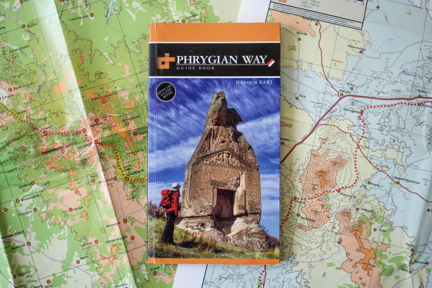
-If you’re seriously planning on hiking the Phrygian Way, buy the guidebook. The soft volcanic rock is easily eroded and when it rains dust runs down in small streams making it very hard to tell what is the trail and what is just erosion. The guidebook and maps will help you by describing landmarks to watch out for. The guidebook will also help with figuring out where you’ll be able to buy supplies along the route, where to camp, and where the next water source will be.
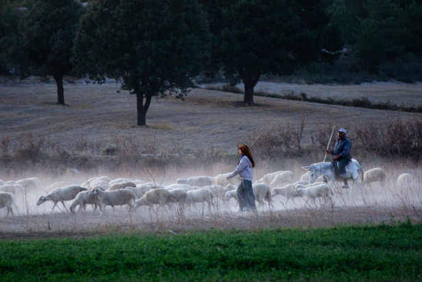
– Watch out for dogs. For the most part wild animals are no issue in Turkey, however, as the Phrygian Way weaves its way through pasturelands, you’ll frequently come into contact with herds and where there are herds there will be the Turkish Akbaş and Kangal sheepdogs keeping watch. Give the herds lots of space if you can. If the shepherd is nearby, he’ll calm the dogs, so call out for him if you find yourself in a situation where you can’t get around the flock.
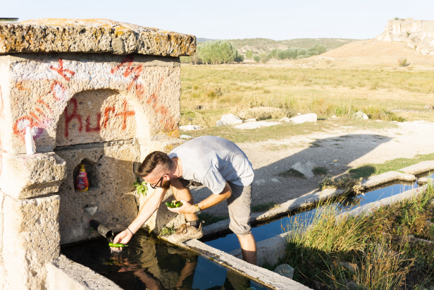
– Water is generally easy to find on the trail, though most of the time you’ll be getting water out of sheep troughs. The water flows into the trough from a spout, so its cleaner than it sounds, though you may still want to bring a personal water filter.
-The idea of walking in the wilderness for its own sake is absolutely bizarre to many Turks and even more so to the villagers that you’ll come across along this trail so don’t be surprised if they treat you with suspicion or want to give you a ride to your destination. Turkey is rife with treasure hunters who have destroyed countless ancient sites in pursuit of artifacts and locals may think that you’re looking for treasure rather than just walking. To avoid increasing suspicion, avoid camping near villages, and don’t bring any digging tools with you.
Camping/Sleeping along the Trail
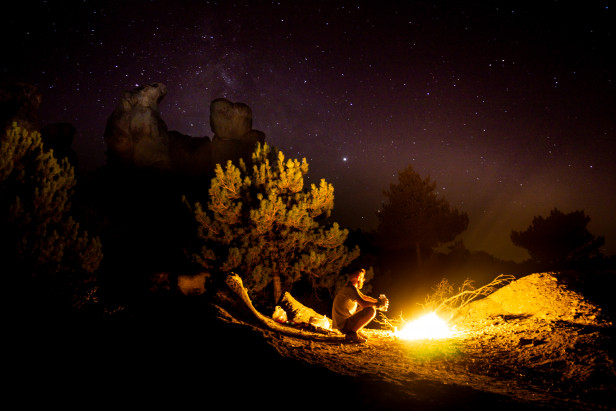
-As mentioned above, hiking is a strange idea to many Turks and while they do camp, it looks very different. Turkish camping involves massive bedrolls, feasting, lots of tea drinking and loud music blasted from a car parked nearby. The minimalistic camping that hikers are restricted to is strange and, to some, suspicious. As such it is best to camp out of site from villages and busy roads. Again, the guidebook comes in handy here as it notes which places are most suitable for camping.
-Another reason to avoid being near villages is the dogs. They will bark and make a racket through much of the night and start again before sunset. Unlike the stone walls of the village homes, your tent won’t do much to block out sound so keep your distance when possible.
-Sadly, the Phrygian Way is not great for hammock camping. Trees are few and sparse for most of the trail, so a normal tent is your best bet.
-As mentioned above, much of this region is used for sheep and goat pasture. Wherever the flocks go you’ll find droppings and where you find droppings you’ll find flies, so when picking a campsite keep an eye out for animal droppings.
How To Get There
General
Other than the East Trailhead, proximity to airports is quite poor. However, Turkey’s bus system is excellent and will easily get you to any of the trailheads. As the trail isn’t a circuit, going by car will still require you to use transit to get back to your vehicle. Your best bet is to leave the car in a nearby city and use public transit to get to the trail itself.
South Trailhead (Seydiler)
The southernmost trailhead is in the province of Afyon. While Afyon doesn’t have an airport, it’s regularly serviced by buses from Istanbul, Ankara, and Antalya. From the Afyon city centre you can take a minibus (leaving from next to the Park Afyon mall). The trail begins at the turnoff for the village of Karakaya, though you may want to get off in Seydiler where you can start your trip by exploring some fairy chimneys and other unique rock formations or the Kırkinler rock caves another 2 km up the road past Seydiler.
West Trailhead (Yeniçiftliği)
The west trailhead is about halfway between the cities of Eskişehir and Kütahya in a place marked as Yeniçiftliği, though you won’t find anything by that name on google maps. There is a sign board marking the trail head on the east side of the road (D230 aka Eskişehir-Kütahya highway) near the western end of the Porsuk Baraj lake, just west of the Frig Vadisi road. Bus trafic bewteen Eskişehir and Kütahya is frequent, just make sure that whatever bus you use is willing to let you out along the road.
Eskişehir is serviced by highspeed train along the Istanbul-Ankara route, and both Istanbul and Ankara have major airports.
East Trailhead (Gordium)
The east trailhead can be found in the village of Yassıhöyük, the site of the ruined capital of the Phrygians. Yassıhöyük village is 18 kms outside of the sizable town of Polat from which you can take a minibus or taxi to the trailhead. Polat is regularly serviced by bus from Ankara and sits along the above-mentioned highspeed train route between Istanbul and Ankara, both of which have international airports.
Where To Stay
For places to stay NEAR the trail the cities of Afyon, Ankara, Polat, Kütahya, and Eskişehir are all close to access points to the trail and have good accommodation selection.
Other Tips
Planning on taking on the Phrygian Way? Check out our guides to the nearby cities of Afyon and Ankara as well as the other sights that the region has to offer.
Subscribe to the Art of Wayfaring
Have any tips or info to add? Spot any mistakes? We’d love to hear about it.
