Yazılıkaya – Midas City
Yazılıkaya - Midas Şehri
/ By Josh
Cost: Free
Great for: Phrygian History, Rock-Cut Cities, Iron Age History, King Midas, 10-minute Oil Changes
The Phrygians began their rise to power and cultural influence in Western Turkey around 1200 BC after the old empires of the Bronze Age collapsed. The Phrygians developed new art, technologies, and architecture specially suited to the unique landscape and terrain of their homeland. Layers of soft volcanic stone were eroded into cliff faces, tall spires, and strange humps looking more like icebergs in the pine covered hills. Home to some of the greatest Phrygian monuments, Yazılıkaya is arguably the best place to see and explore the unique artistry of these ancient people.
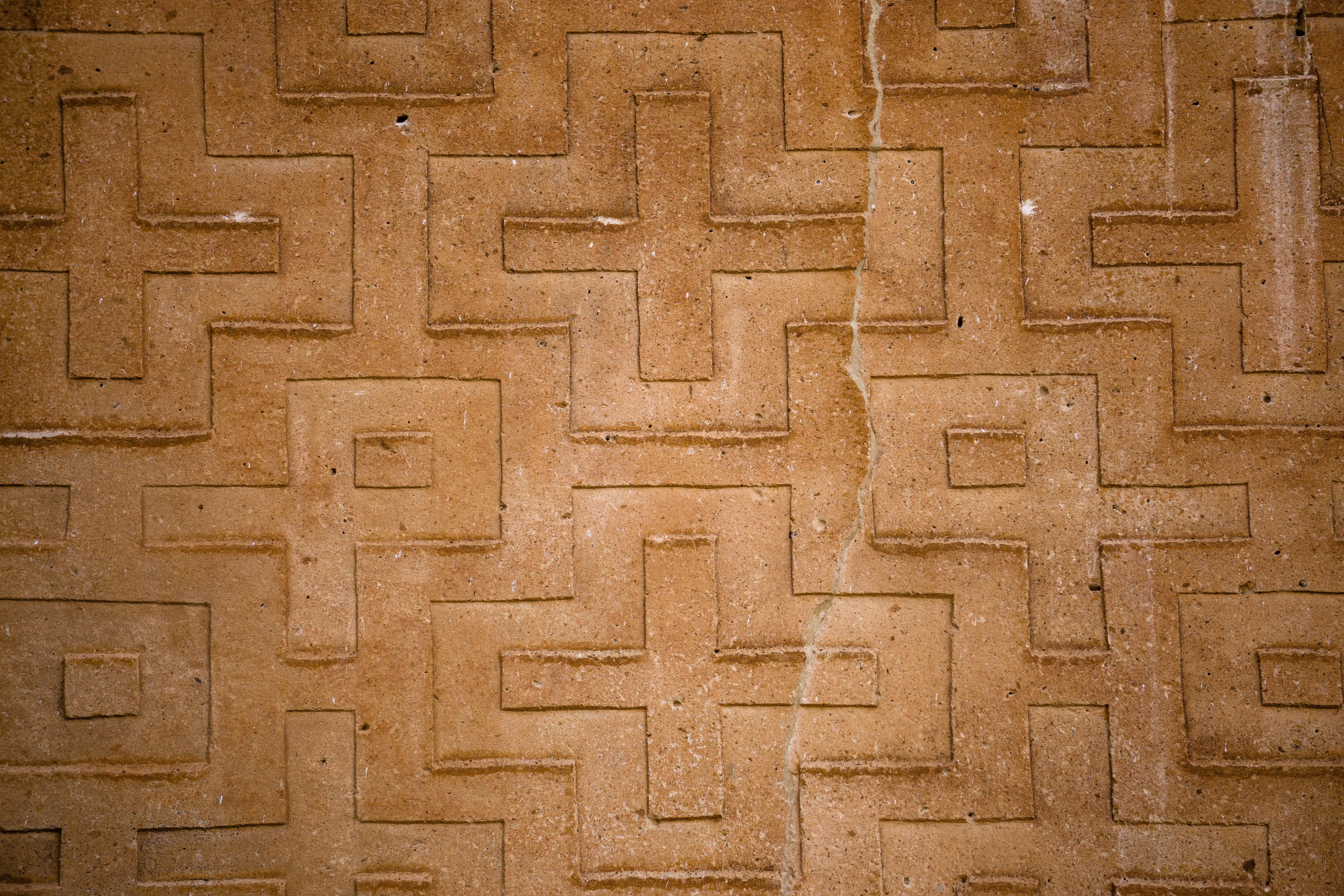
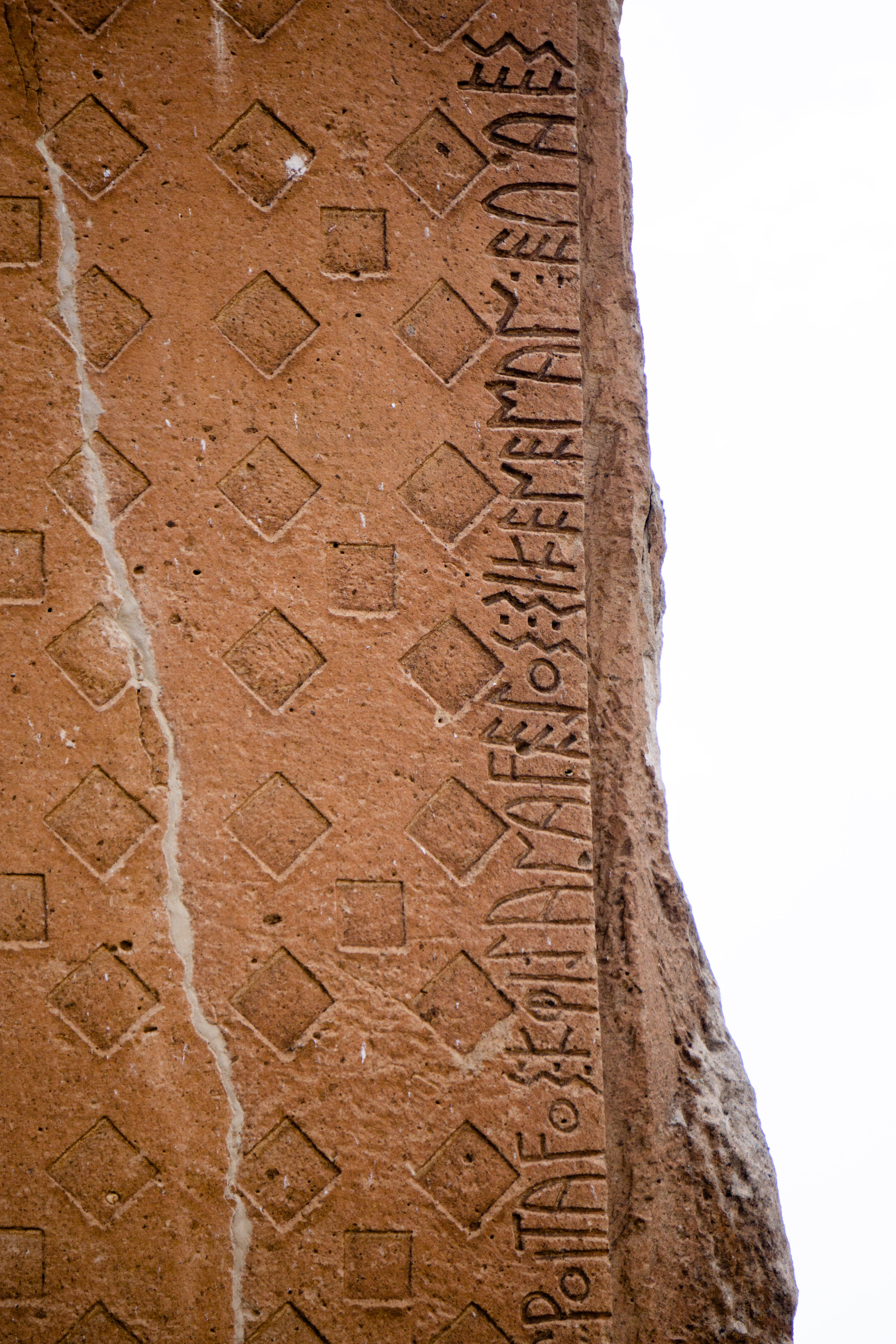
The site is often referred to as Midas City, taking its name from an inscription on the Yazılıkaya monument, though there is no way to know if this Midas is the legendary king Midas with the golden touch. The increasingly popular name for the site is Yazılıkaya, which is Turkish for ‘inscribed rock’, in reference to the carved patterns and Phrygian Language inscriptions that can be found as part of some of the monuments.
(Yazılıkaya is also the name of the Hittite canyon temple site just outside of Hattusha)
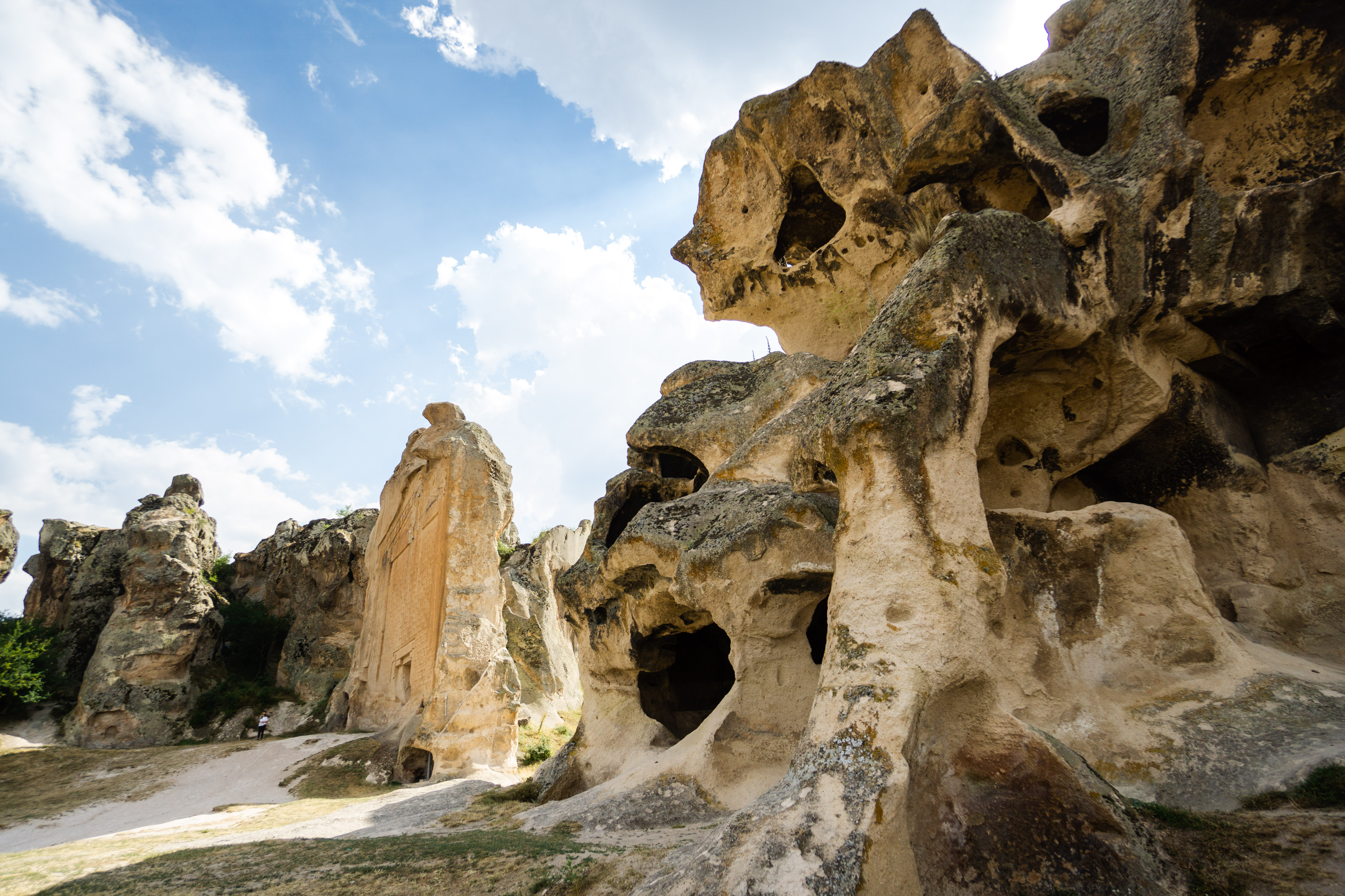
Yazılıkaya was a settlement built atop a seventy-meter-tall mesa or plateau, where early settlers could use the natural cliffs as fortifications. As the city grew in wealth and power the monuments and tombs that make the city famous today were carved into the soft cliff faces.
Why Visit?
The Yazılıkaya City Ruin
The first sight you’ll see when you pass through the gates is the Yazılıkaya Monument, also known as the Midas Monument or Midas Tomb, though, it’s not actually a tomb, and its connection to the legendary King Midas is dubious. The monument is a seventeen-meter-tall shrine to the mother goddess Cybele, it’s believed that the niche at the foot of the monument would have held an idol of the goddess. Running above the top of the face of the monument and along the right side are a pair of inscriptions, regarding the building and dedication of the monument.
To the right of the Midas Monument is a chaotic formation of stone hollowed out with dozens of chambers, their interiors exposed by the erosion of the stone. This rock is called Kırkgöz, which means ‘Forty Eyes’ referring to the openings in the rock. The rock formation is believed to have been used as a settlement during the Byzantine period, when the network of chambers was greatly expanded.
Further along you’ll come across the first of a number of massive cisterns, carved into the rock with a great staircase for access. The rest of the cisterns come just over 100 meters later at the far end of the settlement.
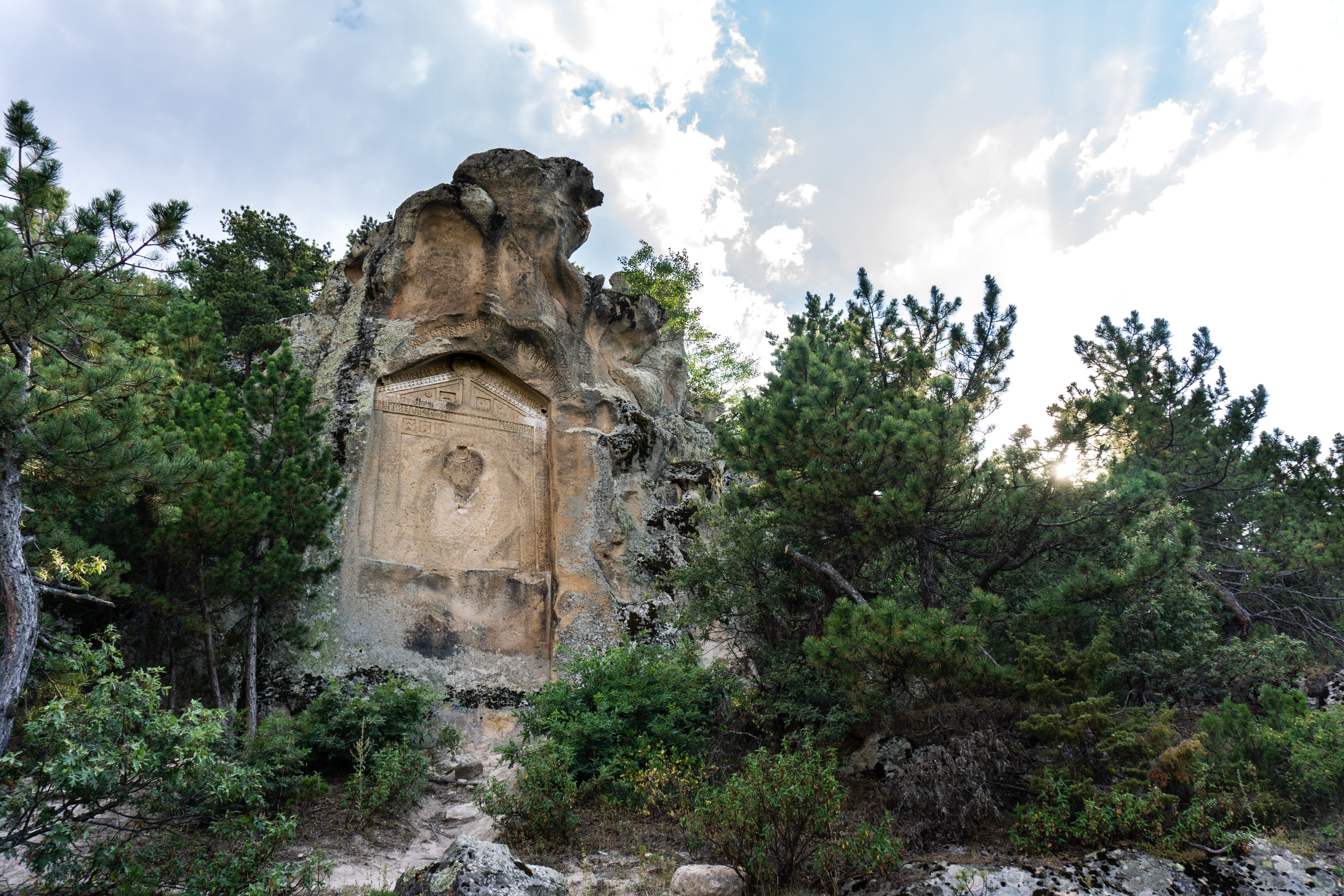
Just past the first cistern is another Phrygian monument carved in a similar style to the first mentioned, though much smaller. Not only is it smaller, but this monument was abandoned unfinished. Why it was never completed can only be guessed at, but it offers researchers an excellent opportunity to study the methods used by the Phrygian craftsmen. Next to the unfinished monument is a small altar. Commonly refered to as Bitmemiş Anıtı (Unfinished Monument), some sources refer to this as Küçük Yazılıkaya (Little Inscribed Rock), which is confusing as there is another site only a few kilometres away by the same name.
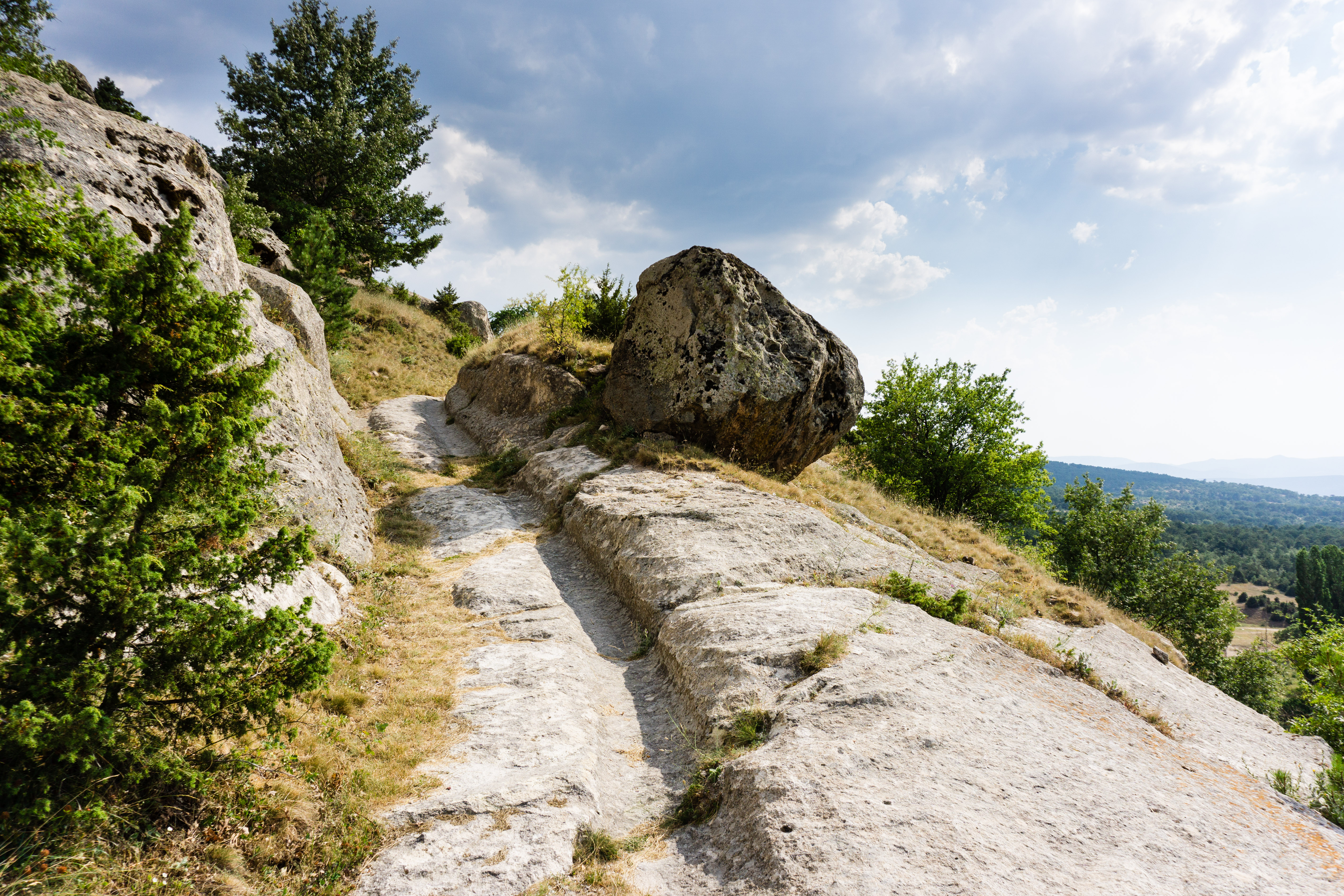
While some portions have been eroded, the remains of a deep rutted road can be seen running parallel to the line of the cliff.
Continuing along in the lower city you will see a small opening on your left for a large chamber tomb. Unfortunately the entrance has been barred to keep out treasure hunters, so there’s little to see. Immediately after the tombs there is a set of massive cisterns. Their size, large stairs, and the presence of animal carvings suggest that these cisterns may have had a religious function beyond simply collecting water.
Up the steep slope and onto the acropolis the remains of the upper city are scant. Most of what remains is what was carved into the base rock itself, the rest of the pieces of masonry has been lost. Here you’ll find a number of altars, countless foundations, and more cisterns. Like many of the objects here, the Midas Throne, is also misnamed. There is no actual link between it and Midas, and, it’s more likely to be a sarcophagus or cistern than a throne, though it is one of the more interesting remains on the acropolis.
Circling back towards the entrance you’ll find a number of graves and tombs in the rock cliff to the left of the Yazılıkaya monument. These are in different styles, built by different peoples in different periods.

The Yazılıkaya Valley
Within a few short kilometres of the Yazılıkaya Settlement there are a number of other interesting sights worth visiting. A number of the rocky hilltops to the north have the remains of small settlements with chambers, stairways, and windows carved out of the living rock. Doğanlı, Pişmiş, and Akpare Castles have good signage and are fairly easy to reach.
The monument of Little (Küçük) Yazılıkaya is particularly striking with its flowing inscriptions curving to the shape of the unworked rock above the smooth face of the monument. Also known as the Areyastis monument, it seems to have been left unfinished, with the lower portions unadorned. While seemingly unfinished the upper portion has managed to survive the weathering of centuries almost unscathed, the inscription and details magnificently clear.
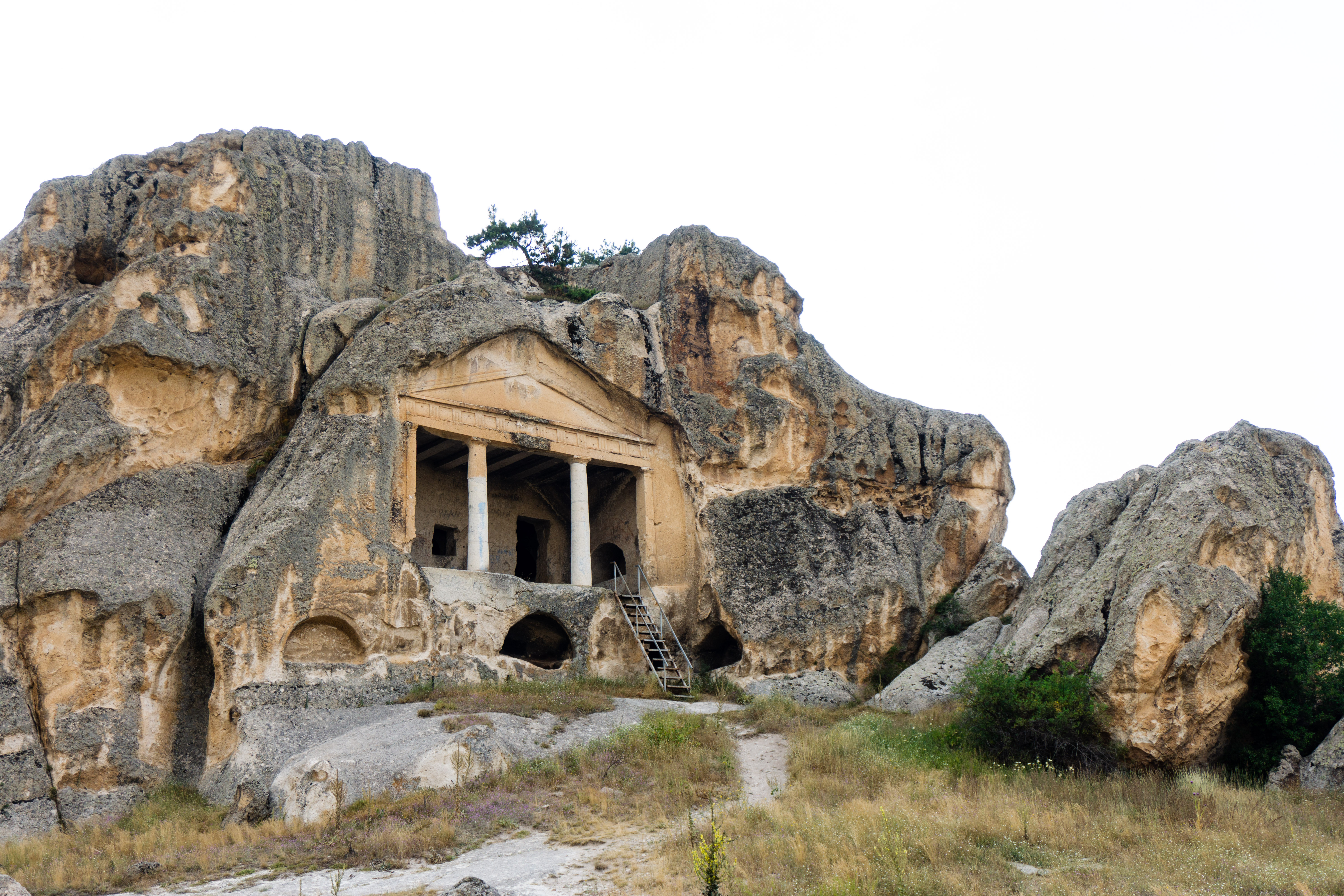
Further north and away from Yazılıkaya is the Gerdekkaya Monument. Meaning “Wedding Rock” Gerdekkaya was probably never intended to host weddings. It’s actually a grand tomb, consisting of a large porch fronted by a pair of Doric pillars, with two tomb chambers carved into the rear. The porch is topped by a façade showing a large triangular pediment. The ceiling of the porch is carved to look like wooden beams.
(Don’t confuse this Gerdekkaya with the similar monument of the same name in the Province of Çorum)
The Village of Kümbet
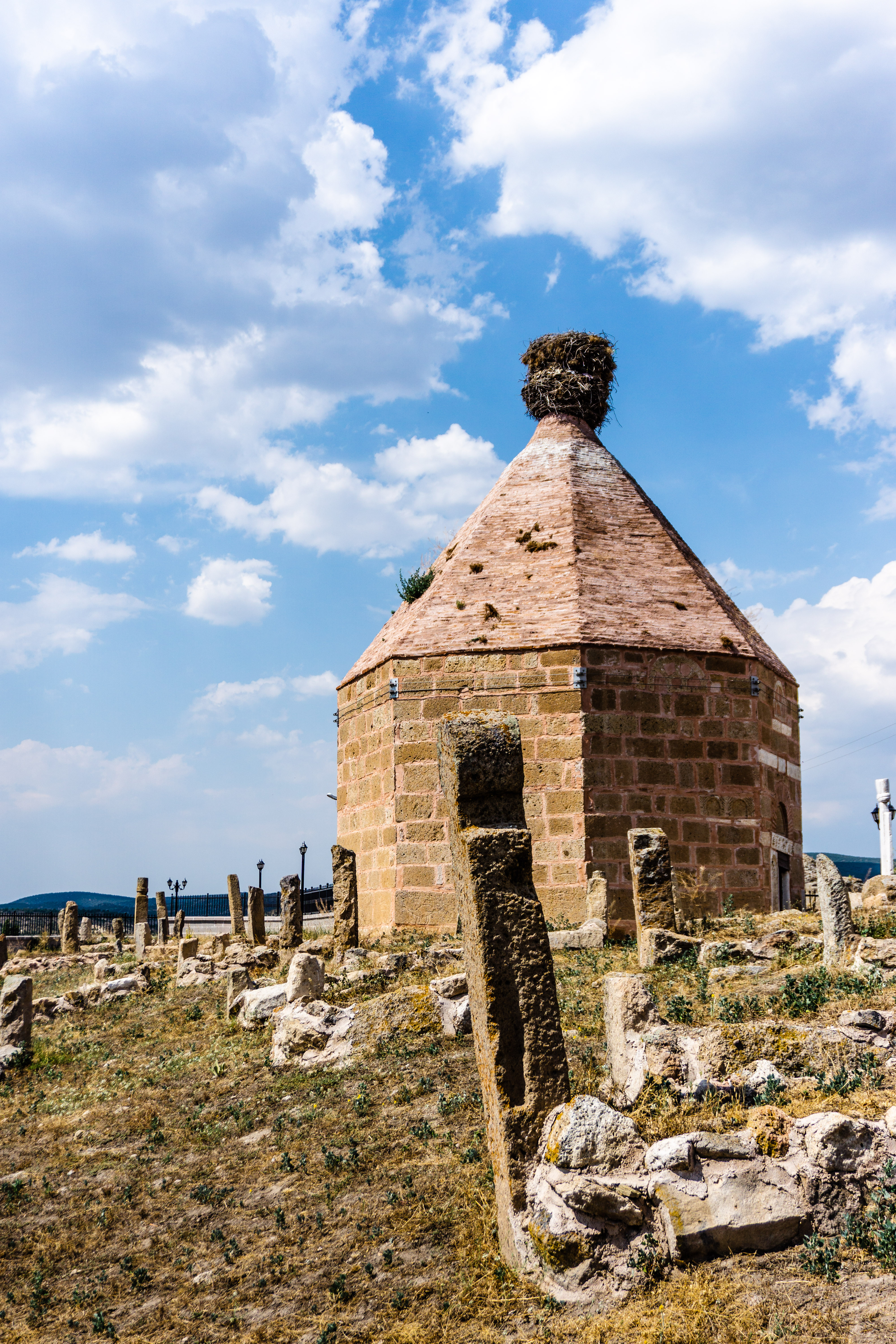
The village of Kümbet, meaning ‘dome or cupola’ takes its name from the domed tomb that sits near the crest of the hill that the village is built on. The tomb, topped with a massive stork’s nest, was built during the Seljuk period, as was the beautiful fireplace carved into the wall of rock. The remains of the house with the fireplace can be found at the pinnacle of the hill just opposite the parking lot next to the tomb.
A short walk into Kümbet village from the Seljuk tomb is a Phrygian monument known as the Aslanlı Mabet (Lion Shrine, which comes from the pair of lions carved into the top of the monument), tucked between village homes and sheds. The small monument was first built by the Phrygians but continued to be used by the Roman and Byzantine era as a tomb.

How To Get There
Hiking/Walking
Yazılıkaya is at the centre of the three branches of the Phrygian Way hiking trail. The trail even runs through the village of Kümbet and up past Little Yazılıkaya and Gerdekkaya. Click here for more about the Phrygian Way hiking trail.
Car
The region around Yazılıkaya is quite rural, small villages are plentiful but towns with public transit are few and far between. To see the other sights around Yazılıkaya such as Kümbet and Gerdekkaya we highly recommend driving. Yazılıkaya and its surrounding sights are just off of the D665 highway, about halfway between Afyon (61 kms south) and Eskişehir (67 kms north). Signage here is exceptionally good so finding your way around is quite easy.
For more about car rental and driving in Turkey make sure to read our full drivers guide.
Taxi/Public Transit
If you’re coming from Eskişehir, you can take a bus to the Town of Seyitgazi. From Seyitgazi it’s possible to take a taxi the remaining 30 kms.
Where To Stay
Within the village of Yazılıkaya there is a small pension or hostel, and in the village of Çukurca, there is the Midas Han in an attractive old stone house. Beyond these there aren’t many options close by.
As a central point along the Phrygian Way its possible to camp in the general vicinity of the village, just keep in mind that many fields are owned by farmers who may not appreciate you setting up in their pasture. Also, you may wake up to animals in your face.
If hotels are more your style, Seyitgazi has some very limited options (31 kms north), otherwise the Town of Gazlıgöl (42 kms south) is full of hotels and resort-style thermal spa hotels.
The cities of Eskişehir (67 kms north) and Afyon (61 kms south) both have plenty of hotel options as well.
Other Tips
Planning on visiting Yazılıkaya? Make sure to check out the rest of the Phrygian Valley, and the Central Anatolian region.
Have any tips or info to add? Spot any mistakes? We’d love to hear about it.